Overview
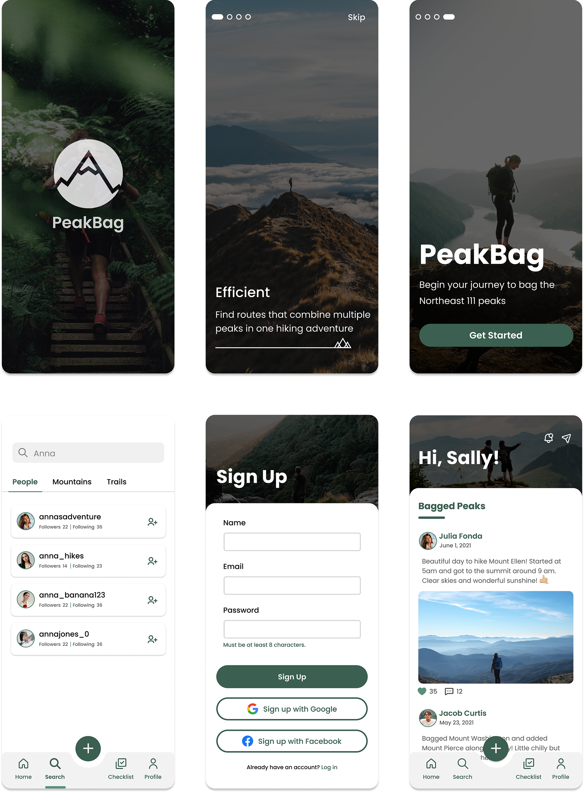
PeakBag helps hikers stay on track while working through the Northeast 111 by giving them an easy way to check off peaks, see their progress, and share their journey with other hikers doing the same thing. It’s part checklist, part hiking log, and part community.
Tools: Figma, Adobe Illustrator

Background
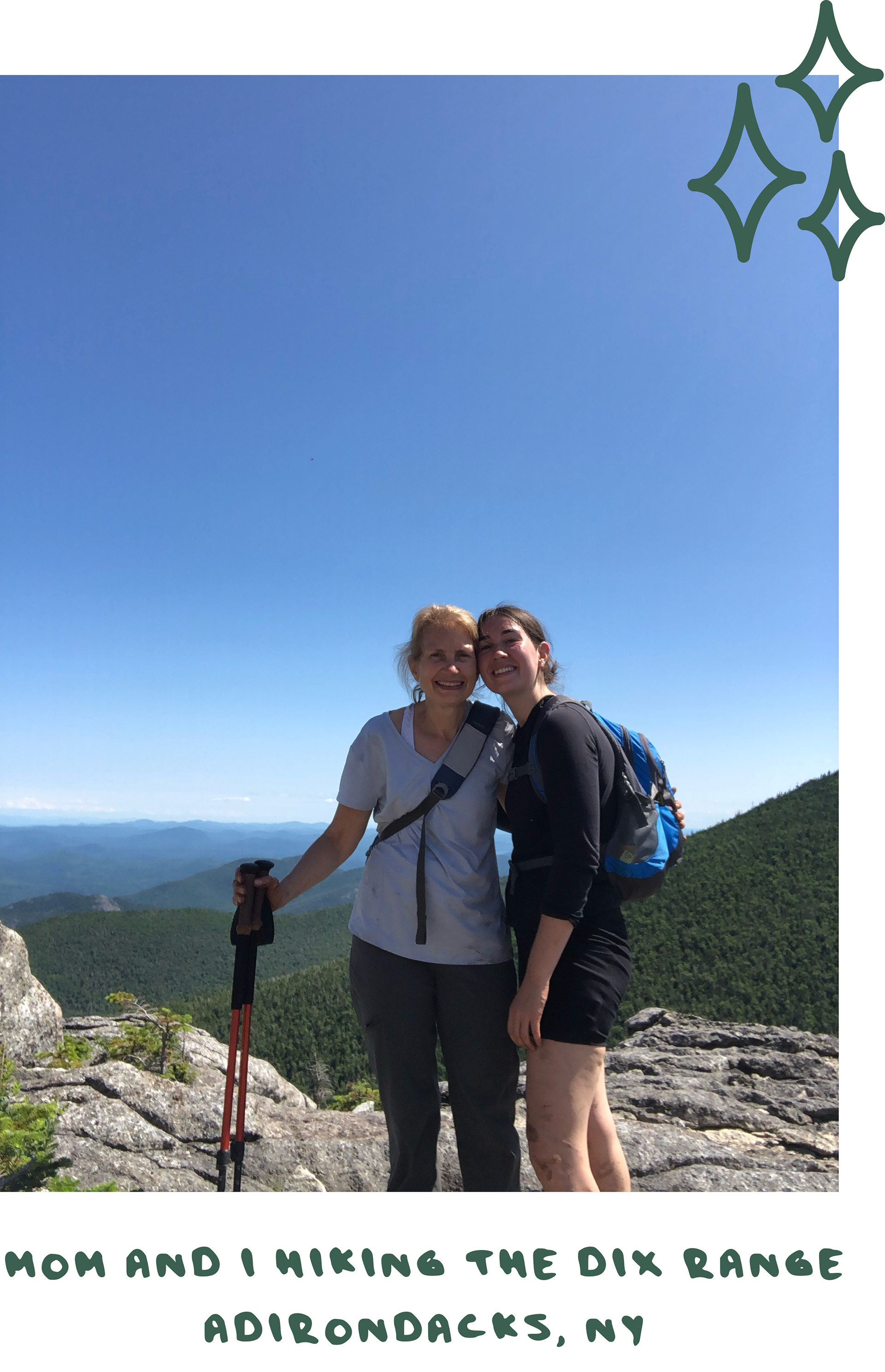
My mom and I have been hiking the Adirondack 46ers together for the past ten years. It’s been one of the most meaningful things we’ve shared. Early mornings, tough climbs, stunning views, and a lot of apples. Along the way, we’ve taken tons of photos, celebrated each summit, and slowly chipped away at the full list.
Over the years, we’ve run into the same issue again and again. We forget to scratch off peaks on our peak chart, forget to label our photos, or just lose track of which mountains we’ve actually done.
There’s no single app designed specifically for Northeast 111 hikers to to track their progress, record memories, and connect with others. Most people rely on scattered tools like paper lists, spreadsheets, and memory. What about a digital place for us to keep track of the peaks we have bagged?
The Northeast 111

The Northeast 111 is a list of 4,000-foot mountains in the northeastern states of the United States. It includes the 48 in the White Mountains of New Hampshire, 14 in Maine, 5 in the Green Mountains of Vermont, the 46 Adirondack High Peaks, and Slide and Hunter Mountain, both in the Catskills of New York.
There are actually 115 peaks on the list but is still referred to as the "Northeast 111" because that name predates the additions of Galehead Mountain, Bondcliff, Mount Redington, and Spaulding Mountain.

Research
To better understand the needs of Northeast 111 hikers, I conducted:
User Interviews: One-on-one conversations with 5 hikers, including both those actively working on the 111 and casual peakbaggers, to learn about their tracking habits, frustrations, and community needs.
Surveys: Distributed an online survey to 20+ hikers through Facebook Northeast 111, New Hampshire 48, and Adirondack 46er groups to gather insights on how they currently keep track of their climbs, what features they’d find helpful, and how they engage with other hikers.
Insights:
Users need a way to track hikes that’s effortless, in-the-moment, and works offline.
There’s a strong desire for community and connection
A personalized progress map increases motivation and makes the journey visual.
Pain Points:
Duplicate or missed peaks
Inconsistent logging tools
No way to efficiently log hikes in the moment
Hard to stay motivated
Lack of a focused hiking community
Personas
I created personas based on surveys, conversations, and personal experience hiking the Adirondack 46ers. They reflect the real needs and frustrations of long-term peakbaggers, and guided my design decisions toward more intuitive, meaningful, and emotionally resonant solutions.
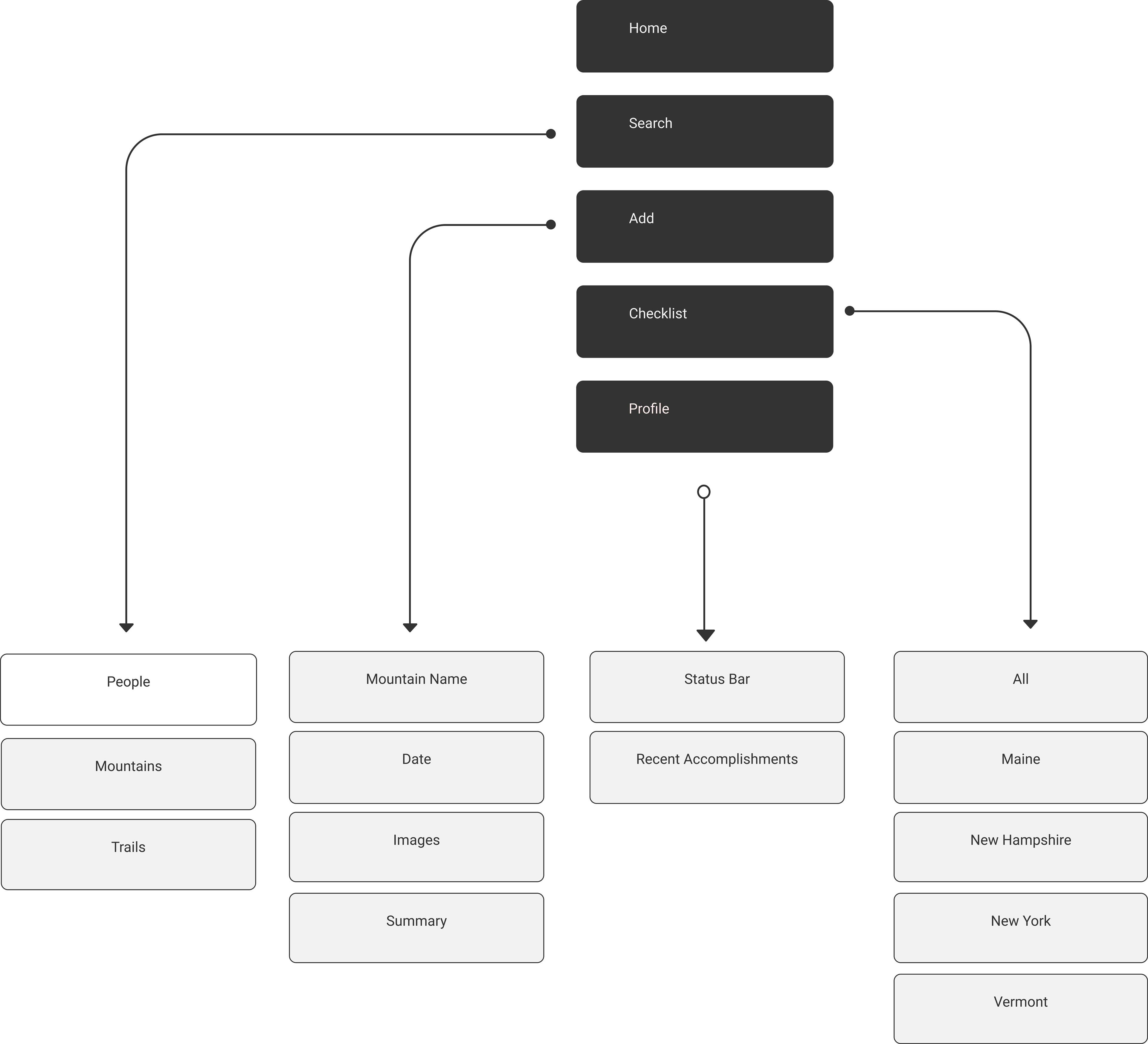
Flow Chart
Wireframes

UI Design System


High Fidelity Wireframes